


Eight counties in the southeast and east are under status yellow rain warnings today.
Carlow, Kilkenny, Wexford, Cork and Waterford are under the warning until 3 o'clock on Tuesday afternoon, while Dublin, Louth and Wicklow are under the warning until 9 pm.
Met Éireann says the wet conditions come as soils are already saturated, along with high river levels and spring tides due in coastal areas.
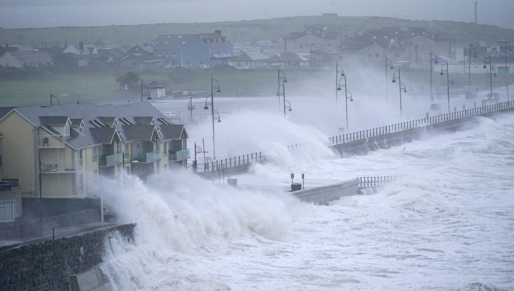 Waves at high tide in Tramore in County Waterford. September 2023.
Holly O’Neill, Meteorologist with Met Eireann, said the impacts of today's rain will continue after the warnings have expired.
"Even if that rainfall warning expires at 9 pm tonight, it'll be a gradual receding of those water levels.
"So it's not just 'on the dot' that we're going be seeing these impacts stopping. They're going to continue regardless of how much rain actually falls across the period today".
" Where those [areas of low pressure] are tracking, and where that rain is moving over, it's looking right now that we'll see a pattern of it moving over the southeast, and there's nowhere for that rain to go.
"The rivers are already high or at 'bankfull' conditions, while the ground is already saturated.
"The rainfall in those areas are going to have the greatest impacts in that regard because they've been impacted for a longer period of time compared to other counties, for example".
Last week communities in Wexford, Kilkenny, Wicklow and Dublin were hit with flooding as Storm Chandra brought heavy rain and strong winds.
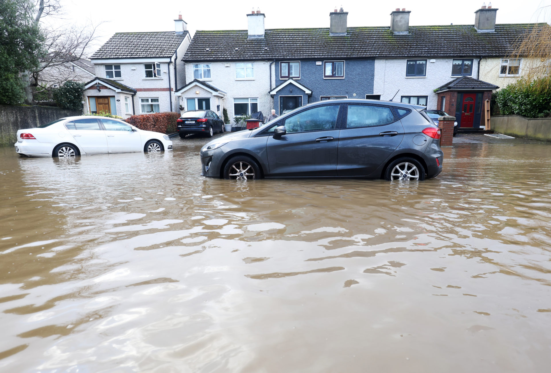 27/01/2026 Dublin, Ireland. Cars on Nutgrove Avenue Rathfarnham as the River Dodder flooded in Dublin. Met Eireann has issued multiple warnings Storm Chanrda brings flooding, power outages, fallen trees and hazardous travelling conditions across Ireland. Photograph: Leah Farrell / © RollingNews.ie
Keith Leonard, Chairperson of the National Emergency Coordination Group, said local authorities where river levels are high are on-alert.
"It is very difficult to know exactly where this is going to manifest. But we have a fair idea that the Nore, the Suir the Barrow, the Slaney, the Liffey Valley catchments are certainly going to see impacts across the next number of days.
Local authorities right across that east region area are on high alert and have engineers out monitoring the water levels in real-time in many of the catchments.
Mr Leonard said local authorities in affected areas are doing their best to put temporary flood relief measures in place along waterways.
" In some pinch points, there's no doubt there may have to be people moved from their homes. We'd hope those would be very limited operations.
"Generally speaking, local authorities try to do small engineering works or put in temporary flood defenses and temporary operations to try and mitigate the worst impacts of flooding, but there's a point beyond where that just isn't feasible".


